
Land Cover Map 1990
 Land Cover Map 1990 (LCM1990) is a parcel-based thematic classification of satellite image data covering the entire United Kingdom. The map replaces the earlier Land Cover Map of Great Britain (LCMGB), which was produced in the early 1990’s and covered GB.
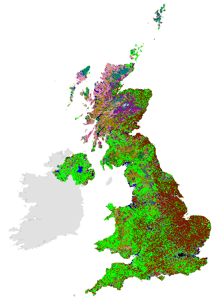
 LCM1990 was produced by the UK Centre for Ecology & Hydrology and is derived from a computer classification of satellite scenes obtained from Landsat. It covers Great Britain and Northern Ireland and incorporates information derived from other ancillary datasets. LCM1990 was classified using a nomenclature corresponding to the Joint Nature Conservation Committee (JNCC) Broad Habitats, which encompasses the entire range of UK habitats. In addition, it recorded further detail where possible. LCM1990 is produced in both vector and raster formats, with a number of different versions containing varying levels of detail and at different spatial resolutions. Refer to the online supporting documentation and lineage statement for information regarding versions.
These are one of a series of land cover maps, produced by UKCEH since 1990. They include versions for 1990, 2000, 2007, 2015, 2017, 2018 and 2019.
This collection contains these resources
publishedDataset
Land Cover Map 1990 (1km dominant aggregate class, N. Ireland)
publishedDataset
Land Cover Map 1990 (1km dominant target class, N. Ireland)
publishedDataset
Land Cover Map 1990 (1km percentage aggregate class, N. Ireland)
publishedDataset
Land Cover Map 1990 (1km percentage target class, N. Ireland)
publishedDataset
Land Cover Map 1990 (1km dominant aggregate class, GB)
publishedDataset
Land Cover Map 1990 (1km dominant target class, GB) v2
publishedDataset
Land Cover Map 1990 (1km percentage aggregate class, GB)
publishedDataset
Land Cover Map 1990 (1km percentage target class, GB) v2
publishedDataset
Land Cover Map 1990 (25m raster, GB) v2
publishedDataset
Land Cover Map 1990 (vector, GB)
publishedDataset
Land Cover Map 1990 (vector, N. Ireland)
publishedDataset
Land Cover Map 1990 (25m raster, N. Ireland)