
Land Cover Map 2017
(LCM2017)
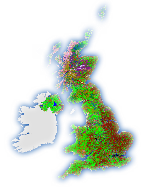 Land Cover Map 2017 (LCM2017) represents a suite of geospatial land cover datasets (raster and polygon) describing the UK land surface in 2017. These were produced at the UK Centre for Ecology & Hydrology by classifying satellite images from 2017. LCM2017 was simultaneously released with LCM2018 and LCM2019.
 These are one of a series of land cover maps, produced by UKCEH since 1990. They include versions in 1990, 2000, 2007, 2015, 2017, 2018 and 2019.
This collection contains these resources
publishedDataset
Land Cover Map 2017 (1km summary rasters, GB and N. Ireland)
publishedWeb service
Land Cover Map 2017 25m raster web service
publishedDataset
Land Cover Map 2017 (20m classified pixels, GB)
publishedDataset
Land Cover Map 2017 (20m classified pixels, N. Ireland)
publishedDataset
Land Cover Map 2017 (25m rasterised land parcels, N. Ireland)
publishedDataset
Land Cover Map 2017 (land parcels, GB)
publishedDataset
Land Cover Map 2017 (land parcels, N. Ireland)
publishedDataset
Land Cover Map 2017 (25m rasterised land parcels, GB)