
Land Cover Map 2021
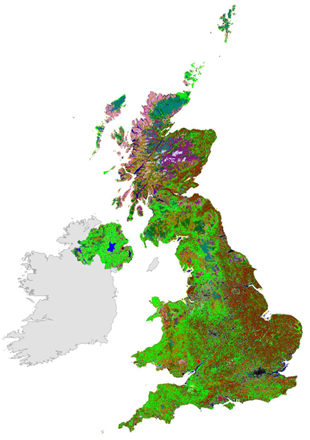 Land Cover Map 2021 (LCM2021) is a suite of geospatial land cover datasets (raster and polygon) describing the UK land surface in 2021. These were produced at the UK Centre for Ecology & Hydrology by classifying satellite images from 2021.
 LCM2021 includes four geospatial datasets each for Great Britain and Northern Ireland:
- 10 m Classified Pixel dataset, classified to create a single mosaic of national cover
- Land Parcel datasets which are the result of intersecting the 10 m Classified Pixel dataset with the UKCEH Land Parcel Spatial Framework to generate land parcel attributes
- 25 m Pixel Rasterised Land Parcel datasets: the result of rasterising the Land Parcel dataset into 25 m pixels
- 1 km summary raster products, summarising dominant land cover class and percentage coverage of each land cover class
LCM2021 is the ninth UK land cover map produced by UKCEH. Previous versions are LCM1990, 2000, 2007, 2015, 2017, 2018, 2019 and 2020.
This collection contains these resources
publishedDataset
Land Cover Map 2021 (1km summary rasters, GB and N. Ireland)
publishedWeb service
Land Cover Map 2021 10m web map service
publishedDataset
Land Cover Map 2021 (10m classified pixels, GB)
publishedDataset
Land Cover Map 2021 (25m rasterised land parcels, GB)
publishedDataset
Land Cover Map 2021 (25m rasterised land parcels, N. Ireland)
publishedDataset
Land Cover Map 2021 (10m classified pixels, N. Ireland)
publishedDataset
Land Cover Map 2021 (land parcels, GB)
publishedDataset
Land Cover Map 2021 (land parcels, N. Ireland)