
Land Cover Map 2020
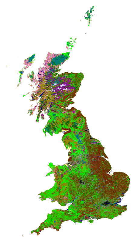 Land Cover Map 2020 (LCM2020) is a suite of geospatial land cover datasets (raster and polygon) describing the UK land surface in 2020. These were produced at the UK Centre for Ecology & Hydrology by classifying satellite images from 2020.
 The 2020 editions provide more detail than ever before, as a high-resolution 10m product is available for the first time.
LCM2020 includes three geospatial datasets:
- 10m Classified Pixel dataset, classified to create a single mosaic of national cover
- Land Parcel datasets which are the result of intersecting the 10m Classified Pixel dataset with the UKCEH Land Parcel Spatial Framework to generate land parcel attributes
- 25m Pixel Rasterised Land Parcel datasets: the result of rasterising the Land Parcel dataset into 25m pixels
LCM2020 is the eighth UK land cover map produced by UK CEH (others include LCM1990, 2000, 2007, 2015, 2017, 2018, 2019).
This collection contains these resources
publishedDataset
Land Cover Map 2020 (1km summary rasters, GB and N. Ireland)
publishedDataset
Land Cover Map 2020 (land parcels, N. Ireland)
publishedDataset
Land Cover Map 2020 (25m rasterised land parcels, N. Ireland)
publishedDataset
Land Cover Map 2020 (10m classified pixels, N. Ireland)
publishedDataset
Land Cover Map 2020 (25m rasterised land parcels, GB)
publishedDataset
Land Cover Map 2020 (land parcels, GB)
publishedDataset
Land Cover Map 2020 (10m classified pixels, GB)
publishedWeb service
Land Cover Map 2020 10m web map service
publishedWeb service
Land Cover Map 2020 25m web map service